CVOC 2019 1st Day Orienteering at Pocahontas State Park
CVOC held its 1st Day Orienteering Meet in conjunction with the 1st Day Hike event held at Pocahontas State Park. With the mild temps and a break in the rain we have been having, the park was full of people enjoying the 1st day of 2019.
There were 92 plus participants, with 42 starting on either the traditional beginner, intermediate, or advanced courses. Each course was to be completed in the numerical order indicated on the map. As always, club members provided beginner instruction for anyone who needed a refresher. Course designers were Tim Gilbert and Alec Richardson.
 |
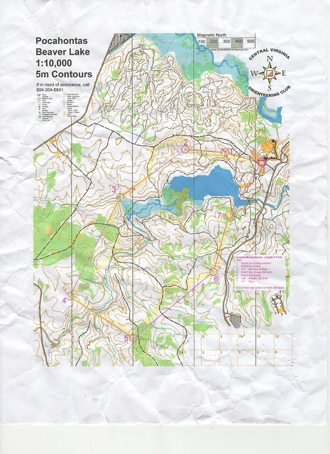
| CVOC advanced course map |
Pictured above is my advanced map of the course. There were only 7 controls on the 4.7km course with distances between 700 and 800 meters on some of the longer legs. Four of the controls were a 4x4 post with a punch, which is part of the permanent orienteering course in the park.
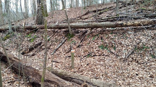
 |
| One of the many permanent course controls |
While there might have only been 7 controls, the course did challenge me in more ways than one. Once I got out of the marsh from leaving control 3, I made my way to the trail. I planned to shoot my bearing from the bridge on the trail, keeping the creek to my left. Right before getting to the area at control 4, I saw the intermittent creek that is shown on the map. I then started to follow the feature to look for the draw that the control would have been in. Just to the left of one of the draws, I see a rock, and I see a black dot on my map. Thinking the rock and the black dot are the same, I think I am too far up. This happens not to be the case, and it cost me some time. From that rock, I was 50 meters away from the control the first time...
Leaving control 4, I hit the wide creek along with one of the other participants. No matter how you tried, you were going to get wet at some point. I think the creek was about 10 feet wide at the point that I crossed.
Oh yes, Control 7 was a hidden gem. There was a nice Popular tree that blocked my view of the control from the route that I took...
I encourage you to get out and try orienteering. If you spend any time in the great outdoors, you need to practice your map and compass skills, and an orienteering meet is a great way to do just that.


Comments