Day Hikes around Beagle Gap || Shenandoah National Park
The plan was to enter the park from the South District and drive north for about 5-7 miles, landing us at Beagle Gap. From there, we could easily tackle two short day hikes. The great thing about Beagle Gap is that it offers the convenience of returning to the car between hikes to drop off or grab gear, plus there are port-a-potties available if needed. It’s an ideal family-friendly trailhead location, allowing us to start our adventure without spending too much time on the Parkway.
Beagle Gap lies between Bear Den Mountain and Little Calf Mountain. What makes this area so unique is that both sides of Skyline Drive are meadows. This meadowland is a remnant of the Royal Orchard, adding a touch of history to the landscape.
 |
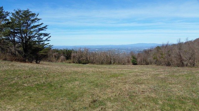
| The lower meadow of Bear Den Mountain overlooks the town of Waynesboro, Virginia. |
The first leg of our hike would take us up to the summit of Bear Den Mountain along the Appalachian Trail. This section of the trail is part of the Appalachian Trail Park, not within Shenandoah National Park. At the top of Bear Den Mountain, we’d find two radio antenna farms, marking the summit with their unmistakable presence.
 |
| Illegal campfire. |
 |
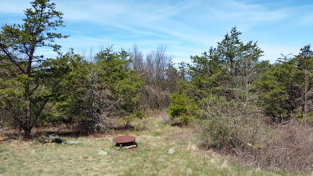
| The family picnic site of the family that had owned the Royal Orchard. |
In the mid-'90s, the view from this spot offered a clear sightline down into the valley. However, over the years, the trees have grown tall and now block the once-open vista. This location, just off the Appalachian Trail, sits near the radio towers, which are positioned behind me in this photo. It's a perfect spot for a lunch break, as there are about four old tractor seats scattered around. Historically, the owners of what was once the Royal Orchard would come here for family picnics and to enjoy the fireworks displays in the valley.
 |
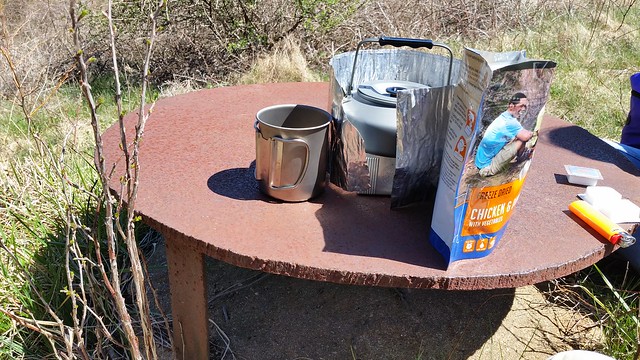
| Time to make lunch. |
I’m not sure how often you come across a half-inch steel table in the mountains, but we found one here, and it made the perfect surface for preparing our lunch. My daughter loves backpacking meals, and she always enjoys helping out with meal prep, making the experience that much more fun.
 |
| Apple tree blooms. |
The old apple trees from the Royal Orchard were just beginning to bloom during our visit. It’s easy to forget that people once lived and farmed in what is now Shenandoah National Park. Over time, the landscape has reclaimed most of these homes and farms, but if you look closely, remnants of them can still be found.
The second leg of our hike took us up to Little Calf Mountain. Just before reaching the summit, we met our first thru-hiker of the season. He had started his journey on February 10th and had just entered the South District of the park. If you have a new PATC map of this section, be aware that the trail on the map doesn’t exactly match what’s on the ground. It’s not a major issue, but something to keep in mind — and the same goes for some tracklogs and other online maps. Again, it's not a huge problem, just a minor note for those navigating the trail.
 |
| Summit of Little Calf Mountain. |
At the summit of Little Calf Mountain, we were greeted by another beautiful meadow — the perfect spot for a lunch break with a stunning view back toward Bear Den Mountain. Afterward, I planned to head to Calf Mountain Shelter, knowing there was a spring there. I was eager to use my Sawyer Mini filter to collect some fresh mountain spring water. It's always important to filter water from any source in the park to ensure it's safe to drink.
The spring itself is in better condition than the sign nearby. Depending on the time of year and rainfall, you might encounter surface water flowing across the trail, but that's not the spring itself. The true spring is marked by a white PVC pipe at its source.
In the picture below, you can see a benchmark that marks the boundary of the Appalachian Trail Park. By the end of the day, I think we had hiked about as far as we did back in October.
 |
| AT Survey Marker. |
Trail Notes:
- Activity: Day Hiking
- Route/Place: Appalachian Trail / Beagle Gap Area
- Activity Type: Day Hiking
- Trail Difficulty:
- Bear Den Mountain: Easy & Kid-Friendly
- Little Calf Mountain: Easy & Kid-Friendly
- Trail Conditions: Well-maintained with clear trail signs and white blazes.
- Waterfalls/Streams: None
- Trip Results: Successful
- Road Conditions: Accessible for all vehicles — access fee required.


Comments